Japan is full of hidden treasures, and the ancient Nakasendō trail, nestled in the heart of the Kiso Valley in the Japanese Alps, is one of them. Once a major route connecting Kyōto and Edo (now Tōkyō), this historic path is now a must-visit for hiking and history enthusiasts.


What is the Nakasendô ?
The Nakasendō (中山道), which means "Central Mountain Road," was one of the five major routes of the Edo period (1603-1868). Stretching about 534 km, it connected Kyōto and Edo with 69 post towns (宿 / juku), which served as inns for travelers, merchants, and samurai.
Unlike the Tōkaidō route, which followed the coast, the Nakasendō ran through inland mountains, making it safer from floods and maritime dangers. It was especially favored by feudal lords and their official processions.
Today, much of the Nakasendō has been overtaken by modern roads, but some sections have been beautifully preserved—especially the trail between Magome Juku and Tsumago Juku, one of the most scenic stretches accessible to hikers.

Why hike the Nakasendô ?
Walking the Nakasendō is like stepping back in time, imagining the days of samurai processions and merchant caravans. This hike offers:
- Authentic Scenery: The villages of Magome Juku and Tsumago Juku have preserved their traditional Edo-period architecture. Even power lines are buried to maintain the historic atmosphere.
- Easy, Accessible Hiking: The well-maintained 8 km trail between Magome and Tsumago is relatively easy and ideal for beginners and families.
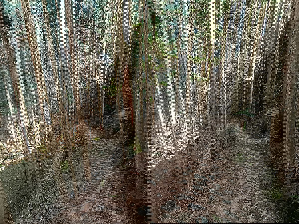
- Stunning Nature: The route winds through cedar forests, alongside crystal-clear rivers, and offers breathtaking views of the Kiso Valley.
- Cultural Immersion: Along the way, you can enjoy free tea in a rest house, admire waterfalls, or try local specialties like gohei mochi (grilled rice skewers with a sweet sauce).


Recommended Itinerary for the Nakasendō Hike
A classic route starts in Nakatsugawa and ends in Nagiso, passing through Magome and Tsumago.
- JR Nakatsugawa Station to Magome Juku – 9 km / 3 hours
- Magome Juku to Tsumago Juku – 8 km / 2 hours
- Tsumago Juku to JR Nagiso Station – 4 km / 1 hour
This hike can be completed in a day, but for a more immersive experience, consider spending a night in a traditional inn (ryokan).
Find the full itinerary and key points of interest on our Google Map.

1. JR Nakatsugawa Station to Magome Juku (9 km / 3h)
Your journey begins at JR Nakatsugawa Station (中津川). From there, you can:
- Take a bus to Magome Juku (30 min, 800 ¥).
- Walk all the way to Magome (3 hours)—a longer but scenic route.
Along the way, you’ll pass Ochiai Juku, another historic post town with Edo-period houses. You'll also cross bamboo forests and rolling hills before reaching Magome Juku.
Near Magome, you’ll find signposts in Japanese explaining the different route options created over the years for easier passage. Whichever path you choose, you’ll end up at the same destination—Magome Juku!


2. Magome Juku: a village frozen in time
Upon arrival at Magome Juku (馬籠宿), you’ll be greeted by stunning panoramic views of the Kiso Valley. Its stone-paved streets, wooden houses, waterwheels, and traditional shops make it look like a postcard from the Edo period.
Highlights in Magome Juku:
- Historic inns: Walk through beautifully preserved Edo-era lodging houses.
- Try gohei mochi: Grilled rice skewers coated in a sweet soy-based sauce.
- HillBilly Coffee Company: A cozy café with a great view.
- Tōson Memorial Museum: Dedicated to writer Shimazaki Tōson, a Magome native.


3. Magome Juku to Tsumago Juku: a nature walk (8 km / 2h)
This is the most scenic section of the Nakasendō: a quiet 8 km trail weaving through forests, rice fields, and waterfalls.
Along the way, you’ll notice bear warning bells. While actual bear encounters are rare, locals advise ringing the bells to alert wildlife to your presence.
Points of Interest Along the Trail:
- Free tea house: Enjoy complimentary tea and a snack.
- Odaki and Medaki Waterfalls: A refreshing stop in the middle of nature.


4. Tsumago Juku: The Gem of the Nakasendô
Tsumago Juku (妻籠宿) is one of Japan’s best-preserved Edo-period villages. Cars are banned during the day, and locals actively maintain the traditional ambiance.
Must-See in Tsumago Juku:
- Wakihonjin Residence: A former inn for high-ranking samurai.
- Try oyaki: Local stuffed dumplings.
- Kotoku-ji Shrine: A small, serene temple hidden in the woods.


5. Tsumago Juku to JR Nagiso Station (4 km / 1h)
The final stretch follows the Kiso River through a peaceful forest.
At JR Nagiso Station, you can catch a train back to Nagoya or Matsumoto. Be sure to check the schedule in advance, as trains here are infrequent.


How to get to the Nakasendō
From Tōkyō:
- Take a Shinkansen to Nagoya (1h40, covered by the JR Pass).
- Transfer to the JR Chūō Line to Nakatsugawa (50 min).
- Take a bus (30 min, 800 ¥) or hike to Magome Juku.
From Kyōto:
- Take a train to Nagoya (35 min).
- Transfer to the JR Chūō Line to Nakatsugawa (50 min).
- Continue by bus or foot to Magome Juku.
From Matsumoto:
- Take the JR Chūō Line to Nagiso (1h30) or Nakatsugawa (2h).
- Continue by bus or foot to Tsumago or Magome.
Use JR Express trains on the JR Chūō Line to avoid unnecessary stops. The route is covered by the JR National Pass or JR Regional Passes.

Practical tips for hiking the Nakasendô
Best Seasons to Visit
- Spring (March-May): Pleasant weather.
- Autumn (September-November): Stunning red foliage.
- Summer (June-August): Hot, humid, and mosquito-heavy.
- Winter (December-February): Possible snow and icy trails.
What to Bring
- Water bottle: No vending machines between villages.
- Hiking shoes: Trails can be slippery after rain.
- Cash:w Most local businesses only accept cash.
Luggage Transport Service
A luggage transport service is available between Nakatsugawa, Nagiso, Magome Juku, and Tsumago Juku.
- Price: 1,000 to 3,000 yen per bag (~7 € to 20 €)
- Operating hours: 8:40 AM - 11:40 AM (bags can be collected between 1:00 PM - 5:00 PM)
- Available from: March 20 - late November (closed in winter)
Where to Stay on the Nakasendō?
For a more immersive experience, staying in a traditional inn (ryokan) is highly recommended. You’ll sleep on a futon, enjoy a kaiseki meal, and experience travel as it was in the Edo period! However, since the region is quite rural, accommodations are limited—it's best to book in advance.
In Nakatsugawa
- The RYOKAN O: A modern hotel with Japanese-style rooms right in front of the JR station (from 80 €).
- Onn Nakatsugawa: A 4-star hotel with Western-style rooms (from 160 €).
In Magome Juku
- Tajimaya Ryokan: A 3-star traditional inn in a historic house with an onsen and local cuisine (from 130 €, including dinner and breakfast).
- Magome Chaya: A warm and cozy traditional guesthouse (from 75 €).
In Tsumago Juku
Unfortunately, we didn’t find any notable accommodations directly in Tsumago. It’s best to stay in Nakatsugawa or Nagiso.
In Nagiso
- Oyado Katsu: A beautiful 3-star ryokan with balconies overlooking the mountains (from 160 €).
